![](/images/other/stat-length.png)
![Excursión A pie Dietfurt an der Altmühl - Jurasteig Tillyland-Schlaufe - Photo](https://media.geolcdn.com/t/1900/400/cc3bc6e1-b2fc-4048-994a-81e61f02ba18.jpeg&format=pjpeg&maxdim=2)
Jurasteig Tillyland-Schlaufe
SityTrail - itinéraires balisés pédestres
Tous les sentiers balisés d’Europe GUIDE+
![Longitud](/images/other/stat-length.png)
Longitud
18,4 km
![Altitud máxima](https://static1.geolcdn.com/siteimages/upload/files/1508320355ic_sort_altitude_max_24dp.png)
Altitud máxima
503 m
![Desnivel positivo](https://static1.geolcdn.com/siteimages/upload/files/1508320355ic_sort_den_pos_24dp.png)
Desnivel positivo
459 m
![Km-Effort](/images/other/stat-length.png)
Km-Effort
25 km
![Altitud mínima](https://static1.geolcdn.com/siteimages/upload/files/1508320355ic_sort_altitude_min_24dp.png)
Altitud mínima
363 m
![Desnivel negativo](https://static1.geolcdn.com/siteimages/upload/files/1508320355ic_sort_den_neg_24dp.png)
Desnivel negativo
459 m
![Boucle](https://static1.geolcdn.com/siteimages/upload/files/16400158638029165_repeat_loop_refresh_sync_direction_icon.png)
Boucle
Sí
Baliza
Fecha de creación :
2022-02-11 14:06:10.008
Última modificación :
2022-02-11 14:06:10.008
![A pie](https://static1.geolcdn.com/sitytour/trail-icons/100.png)
5h34
Dificultad : Medio
![Escanee este código QR para abrir la excursión en la aplicación SityTrail](https://capi.geolives.com/qq0zvz2zws4bq2lad0pu/sitytour/trails/3091931/qr.png?size=200)
Aplicación GPS de excursión GRATIS
A propósito
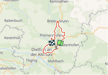
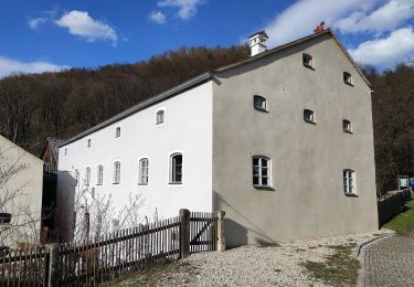
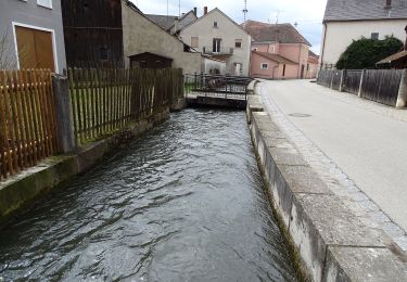
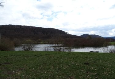
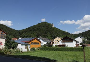
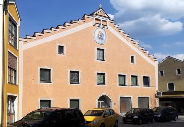
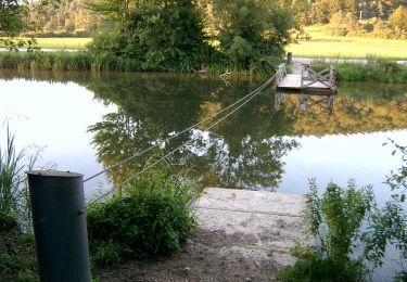
Ruta A pie de 18,4 km a descubrir en Baviera, Landkreis Neumarkt in der Oberpfalz, Dietfurt an der Altmühl. Esta ruta ha sido propuesta por SityTrail - itinéraires balisés pédestres.
Descripción
Trail created by Gebietsgemeinschaft Bayerischer Jura.
geprüft (April 2014, by cycling_zno)
Symbol: Gelbe Schleife auf blauem Grund
Localización
País:
Germany
Región :
Baviera
Departamento/provincia :
Landkreis Neumarkt in der Oberpfalz
Municipio :
Dietfurt an der Altmühl
Localidad:
Unknown
Salida:(Dec)
Salida:(UTM)
691268 ; 5435158 (32U) N.
Comentarios
Excursiones cerca
![Excursión A pie Breitenbrunn - Wasserbüffelweg - Photo](https://media.geolcdn.com/t/375/260/4ee78c09-d7d8-40aa-9b66-39e45d976375.jpeg&format=jpg&maxdim=2)
![A pie A pie](https://static1.geolcdn.com/sitytour/trail-icons/100.png)
Wasserbüffelweg
A pie
Fácil
Breitenbrunn,
Baviera,
Landkreis Neumarkt in der Oberpfalz,
Germany
![](/images/other/stat-length.png)
15,3 km | 19,6 km-effort
4h 27min
![](https://static1.geolcdn.com/siteimages/upload/files/16400158638029165_repeat_loop_refresh_sync_direction_icon.png)
No
![Excursión A pie Breitenbrunn - Rosenweg - Photo](https://media.geolcdn.com/t/375/260/4ee78c09-d7d8-40aa-9b66-39e45d976375.jpeg&format=jpg&maxdim=2)
![A pie A pie](https://static1.geolcdn.com/sitytour/trail-icons/100.png)
Rosenweg
A pie
Fácil
Breitenbrunn,
Baviera,
Landkreis Neumarkt in der Oberpfalz,
Germany
![](/images/other/stat-length.png)
6,6 km | 8 km-effort
1h 49min
![](https://static1.geolcdn.com/siteimages/upload/files/16400158638029165_repeat_loop_refresh_sync_direction_icon.png)
No
![Excursión A pie Dietfurt an der Altmühl - Dietfurter Wasserwege (Technik & Natur) - Photo](https://media.geolcdn.com/t/375/260/7fa80b07-24d7-49ad-92b8-2004a04c8b75.jpeg&format=jpg&maxdim=2)
![A pie A pie](https://static1.geolcdn.com/sitytour/trail-icons/100.png)
Dietfurter Wasserwege (Technik & Natur)
A pie
Fácil
Dietfurt an der Altmühl,
Baviera,
Landkreis Neumarkt in der Oberpfalz,
Germany
![](/images/other/stat-length.png)
5,1 km | 5,5 km-effort
1h 15min
![](https://static1.geolcdn.com/siteimages/upload/files/16400158638029165_repeat_loop_refresh_sync_direction_icon.png)
Sí
![Excursión A pie Dietfurt an der Altmühl - Dietfurter Wasserwege (Zurück zur Quelle) - Photo](https://media.geolcdn.com/t/375/260/40261bff-4a38-444a-b7b0-328635d3bc0e.jpeg&format=jpg&maxdim=2)
![A pie A pie](https://static1.geolcdn.com/sitytour/trail-icons/100.png)
Dietfurter Wasserwege (Zurück zur Quelle)
A pie
Fácil
Dietfurt an der Altmühl,
Baviera,
Landkreis Neumarkt in der Oberpfalz,
Germany
![](/images/other/stat-length.png)
9,5 km | 11,2 km-effort
2h 32min
![](https://static1.geolcdn.com/siteimages/upload/files/16400158638029165_repeat_loop_refresh_sync_direction_icon.png)
No
![Excursión A pie Dietfurt an der Altmühl - Dietfurter Wasserwege (Stadtspaziergang) - Photo](https://media.geolcdn.com/t/375/260/862dc7cb-c5b9-40c3-91cf-087ccb2e4660.jpeg&format=jpg&maxdim=2)
![A pie A pie](https://static1.geolcdn.com/sitytour/trail-icons/100.png)
Dietfurter Wasserwege (Stadtspaziergang)
A pie
Fácil
Dietfurt an der Altmühl,
Baviera,
Landkreis Neumarkt in der Oberpfalz,
Germany
![](/images/other/stat-length.png)
4,2 km | 4,4 km-effort
1h 0min
![](https://static1.geolcdn.com/siteimages/upload/files/16400158638029165_repeat_loop_refresh_sync_direction_icon.png)
Sí
![Excursión A pie Dietfurt an der Altmühl - QiGong-Weg - Photo](https://media.geolcdn.com/t/375/260/8a4e5930-d498-4004-bf3d-ec18db1eb5a0.jpeg&format=jpg&maxdim=2)
![A pie A pie](https://static1.geolcdn.com/sitytour/trail-icons/100.png)
QiGong-Weg
A pie
Fácil
Dietfurt an der Altmühl,
Baviera,
Landkreis Neumarkt in der Oberpfalz,
Germany
![](/images/other/stat-length.png)
3,2 km | 4,2 km-effort
57min
![](https://static1.geolcdn.com/siteimages/upload/files/16400158638029165_repeat_loop_refresh_sync_direction_icon.png)
Sí
![Excursión A pie Dietfurt an der Altmühl - Wildensteiner Steig - Photo](https://media.geolcdn.com/t/375/260/837f69fb-dc78-4893-9844-6bb2e70098cf.jpeg&format=jpg&maxdim=2)
![A pie A pie](https://static1.geolcdn.com/sitytour/trail-icons/100.png)
Wildensteiner Steig
A pie
Fácil
Dietfurt an der Altmühl,
Baviera,
Landkreis Neumarkt in der Oberpfalz,
Germany
![](/images/other/stat-length.png)
10,9 km | 14,1 km-effort
3h 12min
![](https://static1.geolcdn.com/siteimages/upload/files/16400158638029165_repeat_loop_refresh_sync_direction_icon.png)
No
![Excursión A pie Dietfurt an der Altmühl - Walderlebnispfad Wolfsberg - Photo](https://media.geolcdn.com/t/375/260/cc3bc6e1-b2fc-4048-994a-81e61f02ba18.jpeg&format=jpg&maxdim=2)
![A pie A pie](https://static1.geolcdn.com/sitytour/trail-icons/100.png)
Walderlebnispfad Wolfsberg
A pie
Fácil
Dietfurt an der Altmühl,
Baviera,
Landkreis Neumarkt in der Oberpfalz,
Germany
![](/images/other/stat-length.png)
6 km | 8,2 km-effort
1h 51min
![](https://static1.geolcdn.com/siteimages/upload/files/16400158638029165_repeat_loop_refresh_sync_direction_icon.png)
No
![Excursión A pie Dietfurt an der Altmühl - Altmühlbergweg - Photo](https://media.geolcdn.com/t/375/260/9fca1159-7b87-46e1-9972-29b961fbe478.jpeg&format=jpg&maxdim=2)
![A pie A pie](https://static1.geolcdn.com/sitytour/trail-icons/100.png)
Altmühlbergweg
A pie
Fácil
Dietfurt an der Altmühl,
Baviera,
Landkreis Neumarkt in der Oberpfalz,
Germany
![](/images/other/stat-length.png)
8,9 km | 12,2 km-effort
2h 45min
![](https://static1.geolcdn.com/siteimages/upload/files/16400158638029165_repeat_loop_refresh_sync_direction_icon.png)
No